
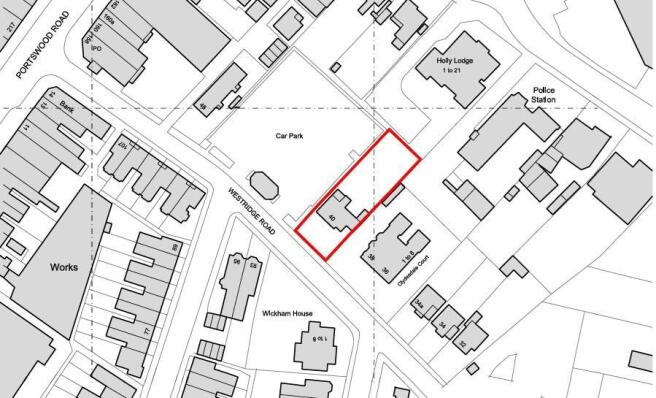
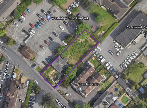
Westridge Road, Southampton
- PROPERTY TYPE
Plot
- SIZE
Ask agent

Key features
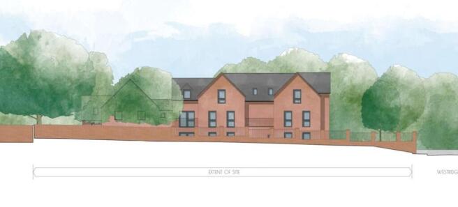
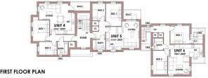
- Full planning permission granted for 8 apartments
- Located in a popular residential location
- Southampton City Council Planning Ref: 24/00306/FUL
- Freehold Development
- Ideal for Developer or Investor
- Close to local amenities
Description
Southampton City Council Planning Ref: 24/00306/FUL
LOCATION:
Portswood is close to Southampton's city centre with its broad range of shops including WestQuay shopping centre, its array of bars, restaurants, cinemas, amenities and mainline railway station is within easy reach. Southampton Airport is also around fifteen minutes away and all main motorway access routes are also close by, including M27, M3 and A3 to London.
SUMMARY OF FEATURES:
Full planning permission granted for 8 apartments; Located in a popular residential location; Southampton City Council Planning Ref: 24/00306/FUL; Freehold Development; Ideal for Developers or Investors; Close to local amenities
GENERAL INFORMATION:
TENURE: Freehold; LOCAL AUTHORITY: Southampton City Council
DISTANCES:
Local Amenities - 2 minute walk; St Denys Station - 0.5 miles; Royal South Hants Hospital - 1.1 miles; Southampton Central Station - 1.9 miles; Southampton General Hospital - 2.3 miles; Southampton Airport - 2.5 miles
Brochures
BrochureWestridge Road, Southampton

NEAREST STATIONS
Distances are straight line measurements from the centre of the postcode- St. Denys Station0.3 miles
- Bitterne Station0.8 miles
- Swaythling Station1.3 miles

Notes
Disclaimer - Property reference 33713523. The information displayed about this property comprises a property advertisement. Rightmove.co.uk makes no warranty as to the accuracy or completeness of the advertisement or any linked or associated information, and Rightmove has no control over the content. This property advertisement does not constitute property particulars. The information is provided and maintained by Taylor Hill & Bond, Warsash. Please contact the selling agent or developer directly to obtain any information which may be available under the terms of The Energy Performance of Buildings (Certificates and Inspections) (England and Wales) Regulations 2007 or the Home Report if in relation to a residential property in Scotland.
Map data ©OpenStreetMap contributors.