The Whole: Sandy Lane, SO32

- PROPERTY TYPE
Land
- SIZE
100,188 sq ft
9,308 sq m
Key features
- SEE AND PRINT PDF SALES PARTICULARS AVAILABLE BELOW
- 2.30 ACRES AS A WHOLE
- AVAILABLE IN TWO LOTS (1.05 & 1.25 ACRES)
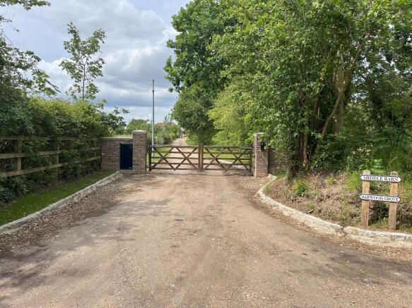
- SECURE ACCESS VIA ELECTRIC GATES
- LEVEL GROUND WITH PADDOCKS FENCED SEPARATELY
- SMALL AREA OF HARDSTANDING TO BOTH PADDOCKS
- WATER & ELECTRICITY SUPPLIED
- SEPARATE ACCESS TO EACH PADDOCK
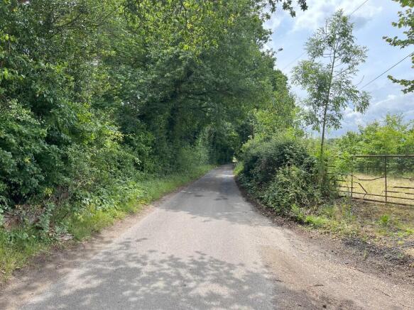
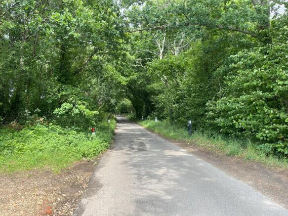
- QUIET COUNTRYSIDE LOCATION
Description
ACCESS: By Transfer dated 8th August 2019, the Vendors benefit from a right of way over the lane from Sandy Lane (hatched brown on the Site Plan) as follows (See Copy of Transfer and Transfer Plan on Selling Agents website):
"a right of way with or without vehicles at all times and for all purposes in connection with the use and enjoyment of the Property over along the Access-Way".
The proposed access arrangements following a sale are set out below:
If both Lots 1 & 2 are sold to the same purchaser: A right of way with or without vehicles at all times and for all purposes will be granted over the lane from Sandy Lane hatched brown on the Site Plan. The purchaser shall be required to make a reasonable contribution of 13.2% (6.6% per Lot) towards the maintenance costs of the lane. Separately a right of way with or without vehicles at all times and for all purposes will be granted over the parts of accessway hatched blue and yellow on the Site Plan. The purchaser shall be required to make a reasonable contribution of 40% (20% per Lot) towards the maintenance costs of this accessway.
If Lots 1 & 2 are sold to separate purchasers: A right of way with or without vehicles at all times and for all purposes will be granted over the lane from Sandy Lane hatched brown on the Site Plan. The purchasers will be required to make a reasonable contribution of 6.6% each towards the maintenance costs of the lane. Separately for Lot 1, a right of way with or without vehicles at all times and for all purposes will be granted over the parts of the accessway hatched blue and yellow on the Site Plan. For Lot 2, the right of way will be only over the track hatched blue. The purchasers will be required to make a reasonable contribution of 20% each towards the maintenance costs of the accessway.
LAND REGISTRY: The Property comprises part of Land Registry Title No. HP836508. The Land Registry Title Register and Plan are available on the Selling Agent's website.
BOUNDARIES AND FENCING: Each Lot is bounded by post and rail fencing. Established native hedging and trees provide screening along the south-western boundary. The proposed boundary maintenance responsibilities following a sale are set out below:
If both Lots 1 & 2 are sold to the same purchaser: The purchaser will be responsible for the maintenance of all fences between the Property sold and the Vendor's retained land. We understand that the fence on the western boundary of Lot 1 is the responsibility of the neighbouring landowner as detailed by Transfer dated 18th November 2020.
If Lots 1 & 2 are sold to separate purchasers: Each purchaser shall be responsible for maintaining the fences between the land they have purchased and the retained land. The purchaser of Lot 1 shall be responsible for maintaining the fence between the Lots 1 and 2.
PLANNING AND PLANNING DESIGATIONS: The Property is outside settlement boundaries and therefore countryside policies restricting development apply under the current Adopted Local Plan from Winchester City Council. There are two planning applications on record as affecting the Property and these are detailed below:
05/01391/FUL - Extension to existing 9-hole golf course. 11 Oct 2005. Application Permitted.
10/02646/FUL - Extension to the time limit for implementing planning permission 05/01391/FUL (Extension to existing 9 hole golf course). 12 Jan 2011. Application Permitted.
The records for these can be found on the Local Planning Authority website. The time period for implementation for both of these applications has now expired. See Planning Authority contact details below.
DESIGNATIONS: The property is situated within the South Hampshire Lowlands National Character area. It is also within a Nitrate Vulnerable Zone. No other significant environmental or planning designations have been identified. Land to the north of the property is within the Cockscomb Down Site of Importance for Nature Conservation (SINC) but this does not directly affect the property.
SERVICES: Each Lot benefits from a metered mains water supply and an electricity supply.
PUBLIC RIGHTS OF WAY: No public rights of way affect the property.
OTHER RIGHTS: There are a number of rights benefitting and burdening the Property which are referred to on the Land Registry Title Register. Prospective buyers are advised to review the Land Registry documentation themselves to fully appraise themselves of these rights. The Land Registry Title Register and Plan are available on the Selling Agent's website. See also Copy of Transfer dated 8th August 2019 and Transfer Plan on Selling Agents website.
By Transfer dated 8th August 2019, there were rights to bring electricity and water supplies through neighbouring land along routes indicated on the Transfer Plan. There were also rights for the neighbouring land owner (previous owner of the Property) to install an electricity supply along a route indicated on the Transfer Plan. It is our understanding that at least some of these rights have already been exercised. There is also a right for the neighbouring landowner to reposition the utilities.
By Transfer dated 8th August 2019, there are requirements on the owners of the land not to obstruct the access-way from Sandy Lane and not to damage the surface of the access-way. There is also a requirement to pay a service charge amounting to 33% of the reasonable and proper cost incurred repairing, renewing and relaying the access-way and any service media shared with the previous owners of the land. Also to maintain good quality stock-proof fencing between the land and the retained land belonging to the previous owner.
COVENANTS: Due to the proximity of their residential property to the land being sold, it is the intention of the Vendors to impose a number of covenants on the Property including:
- Limiting the use of the land to agricultural and equestrian uses, but excluding agricultural uses which have a particular detriment to residential amenity including pigs and poultry.
- Preventing the erection of buildings and structures beyond proportionately size equestrian stables/facilities subject to obtaining the necessary planning consent and also consent of the Vendor such consent not to be unreasonably withheld.
- Preventing nuisance, the erection of advertising boards, the erection of satellite dishes/aerials, the parking of more than two vehicles overnight and the obstruction of/damage to the accessway.
- Allowing the passage and maintenance of utilities across the Property as required for the benefit of the retained land.
LOCAL & PLANNING AUTHORITY: Winchester City Council (WCC), City Offices, Colebrook Street, Winchester, Hampshire, SO23 9LJ. Tel:
Brochures
Sales ParticularsThe Whole: Sandy Lane, SO32

NEAREST STATIONS
Distances are straight line measurements from the centre of the postcode- Botley Station1.9 miles
- Hedge End Station3.4 miles
- Swanwick Station4.1 miles
About Giles Wheeler-Bennett, Southampton
West Court, Lower Basingwell Street, Bishop's Waltham, SO32 1AJ
Notes
Disclaimer - Property reference MiddleWhole. The information displayed about this property comprises a property advertisement. Rightmove.co.uk makes no warranty as to the accuracy or completeness of the advertisement or any linked or associated information, and Rightmove has no control over the content. This property advertisement does not constitute property particulars. The information is provided and maintained by Giles Wheeler-Bennett, Southampton. Please contact the selling agent or developer directly to obtain any information which may be available under the terms of The Energy Performance of Buildings (Certificates and Inspections) (England and Wales) Regulations 2007 or the Home Report if in relation to a residential property in Scotland.
Map data ©OpenStreetMap contributors.