Bones Lane, GU31

- PROPERTY TYPE
Land
- SIZE
111,949 sq ft
10,400 sq m
Key features
- SEE AND PRINT PDF SALES PARTICULARS AVAILABLE BELOW
- SEE DRONE VIDEO FOOTAGE ON THE VIRTUAL TOUR TAB
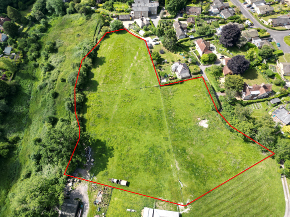
- 2.57 ACRES AS A WHOLE
- ACCESS VIA RIGHT OF WAY FROM BONES LANE
- LEVEL GROUND FENCED INTO THREE PADDOCKS
- WATER SUPPLY AVAILABLE BUT NOT CONNECTED
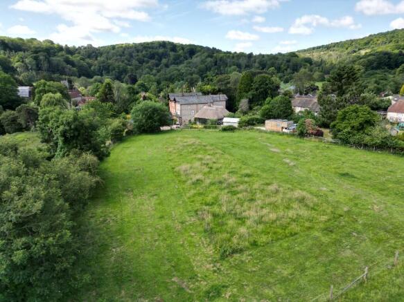
- ATTRACTIVE LOCATION ON EDGE OF VILLAGE
- WITHIN THE SOUTH DOWNS NATIONAL PARK
Description
ACCESS: By Conveyance dated 16th February 1979, a right of way was granted at all times and for all purposes giving access to the Property from Bones Lane as demonstrated by the arrows on the Site Plan. The Vendor has confirmed that no contribution towards maintenance costs has been requested during his ownership. See Selling Agents Website for Copy of Conveyance.
LAND REGISTRY: The Property is currently not registered with the Land Registry. The matter of registration is currently with the Vendor's solicitors and application has been made to the Land Registry providing the necessary evidence for first registration.
BOUNDARIES AND FENCING: The land is bounded by post and wire fencing with mature native hedging and trees along the eastern boundary and parts of the western boundary adjacent to the road.
PLANNING AND PLANNING DESIGATIONS: The property is outside the Buriton settlement boundary which runs down the west side of Bones Lane, before crossing close to the access to the Property. No recent planning applications have been identified relating to the property. See Planning Authority contact details below.
DESIGNATIONS: The property is situated within the South Downs National Park and the South Downs National Character area. No other significant environmental designations have been identified.
SERVICES: The water supply to the land is currently connected to the neighbour's water meter. This will be disconnected prior to completion. The purchaser will therefore have to arrange a new connection to the land. It is likely that a water pipe is present in Bones Lane.
PUBLIC RIGHTS OF WAY: No public rights of way cross the Property. However the Hampshire Map of Definitive Rights of Way shows that public footpath 041/15/2 (Hangers Way) is adjacent to the eastern boundary of the Property.
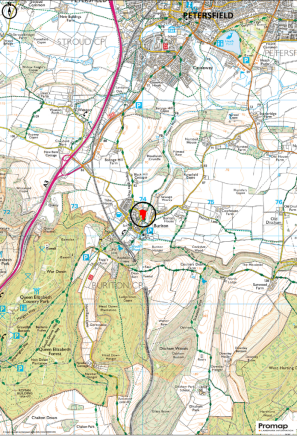
LOCAL AUTHORITY: East Hampshire District Council, PO Box 310, Petersfield, Hampshire, GU32 9HN.
PLANNING AUTHORITY: South Downs National Park (SDNP), South Downs Centre, North Street, Midhurst, West Sussex, GU29 9DH.
Brochures
Sales ParticularsBones Lane, GU31

NEAREST STATIONS
Distances are straight line measurements from the centre of the postcode- Petersfield Station2.1 miles
- Liss Station5.2 miles
About Giles Wheeler-Bennett, Southampton
West Court, Lower Basingwell Street, Bishop's Waltham, SO32 1AJ
Notes
Disclaimer - Property reference BonePaddock. The information displayed about this property comprises a property advertisement. Rightmove.co.uk makes no warranty as to the accuracy or completeness of the advertisement or any linked or associated information, and Rightmove has no control over the content. This property advertisement does not constitute property particulars. The information is provided and maintained by Giles Wheeler-Bennett, Southampton. Please contact the selling agent or developer directly to obtain any information which may be available under the terms of The Energy Performance of Buildings (Certificates and Inspections) (England and Wales) Regulations 2007 or the Home Report if in relation to a residential property in Scotland.
Map data ©OpenStreetMap contributors.