
Lot 5, Throstle Nest Farm, Church Lane, PR3
£0.16 per sq ft
Business rates & charges may apply

- SIZE AVAILABLE
3,179,880 sq ft
295,421 sq m
- SECTOR
Land for sale
Key features
- Farmland
- Great transport links
- Winmarleigh
- Agricultural use
Description
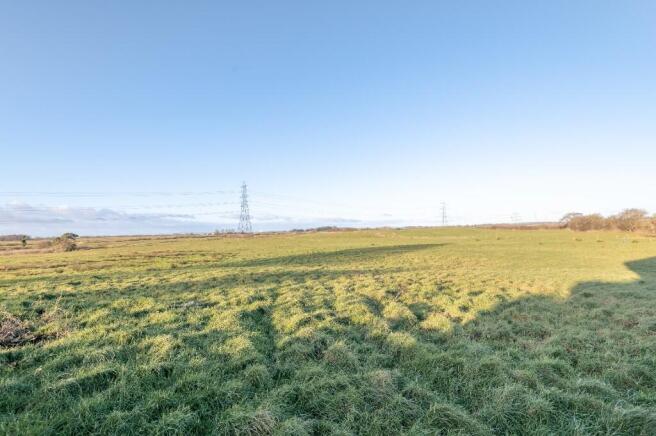
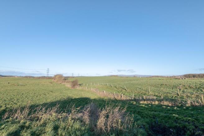
The subject property is currently used as a dairy farm, but lends itself to general livestock production also.
The land at Lot 5 consists of approximately 73 acres of agricultural land. With circa 40 acres being in a Higher Level Stewardship Scheme. More information is available upon request.
Don't miss out on this opportunity, please book in a viewing with Wignalls Chartered Surveyors.
Brochures
Lot 5, Throstle Nest Farm, Church Lane, PR3

NEAREST STATIONS
Distances are straight line measurements from the centre of the postcode- Lancaster Station8.5 miles
Notes
Disclaimer - Property reference C435lot5. The information displayed about this property comprises a property advertisement. Rightmove.co.uk makes no warranty as to the accuracy or completeness of the advertisement or any linked or associated information, and Rightmove has no control over the content. This property advertisement does not constitute property particulars. The information is provided and maintained by Wignalls Chartered Surveyors, Tarleton. Please contact the selling agent or developer directly to obtain any information which may be available under the terms of The Energy Performance of Buildings (Certificates and Inspections) (England and Wales) Regulations 2007 or the Home Report if in relation to a residential property in Scotland.
Map data ©OpenStreetMap contributors.