Land at Lugtrout Lane, Consented Residential Development Opportunity

- SIZE AVAILABLE
205,603 sq ft
19,101 sq m
- SECTOR
Land for sale
Key features
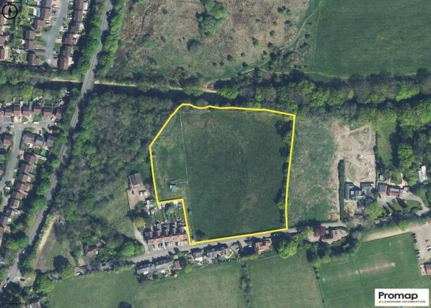
- Residential development opportunity located north of Lugtrout Lane, Solihull.
- The gross site area extends to c. 4.72 acres (1.92 hectares).
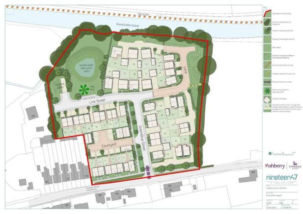
- ‘Resolution to grant’ outline planning permission for up to 50 dwellings
- Offers invited, subject to contract, by 12 noon on the 6th of November 2025.
Description
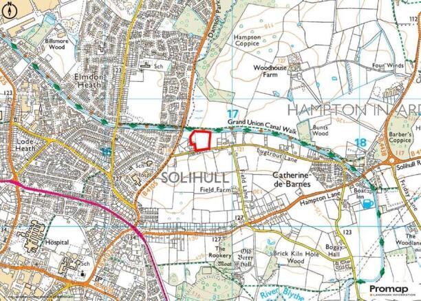
The site is located on the north-eastern edge of Solihull. The site benefits from close proximity to various local amenities including a GP practice, a nursery, a primary school and a number of shops and eateries.
The site is located 1.5 miles north-east of Solihull Town Centre, 10 miles south-east of Birmingham city centre, 13 miles west of Coventry and 24 miles north of Stratford-upon-Avon.
Solihull train station is located 2 miles south-west of the site which offers regular services to London Marylebone (approx. 1hr 50 mins), Birmingham Moor Street (approx. 10 mins). The site is also located approximately 3 miles south of Birmingham Airport.
Brochures
Land at Lugtrout Lane, Consented Residential Development Opportunity

NEAREST STATIONS
Distances are straight line measurements from the centre of the postcode- Solihull Station1.6 miles
- Widney Manor Station2.1 miles
- Birmingham International Station2.3 miles
Notes
Disclaimer - Property reference EE96D52B-38BB-4ABF-AE11-A6E3B7187B07. The information displayed about this property comprises a property advertisement. Rightmove.co.uk makes no warranty as to the accuracy or completeness of the advertisement or any linked or associated information, and Rightmove has no control over the content. This property advertisement does not constitute property particulars. The information is provided and maintained by Savills, Birmingham. Please contact the selling agent or developer directly to obtain any information which may be available under the terms of The Energy Performance of Buildings (Certificates and Inspections) (England and Wales) Regulations 2007 or the Home Report if in relation to a residential property in Scotland.
Map data ©OpenStreetMap contributors.